sentier de la Bienne

fizz1212
User
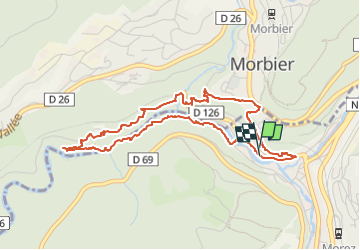

Length
4.7 km

Max alt
813 m

Uphill gradient
203 m
Km-Effort
7.4 km

Min alt
682 m

Downhill gradient
201 m
Boucle
Yes
Creation date :
2022-07-04 08:53:36.746
Updated on :
2022-07-04 10:51:10.8
1h57
Difficulty : Medium

FREE GPS app for hiking
 SityTrail
IGN / Geographical institutes
SityTrail Plus
The world is yours!
About
Trail Walking of 4.7 km to be discovered at Bourgogne-Franche-Comté, Jura, Hauts de Bienne. This trail is proposed by fizz1212.
Description
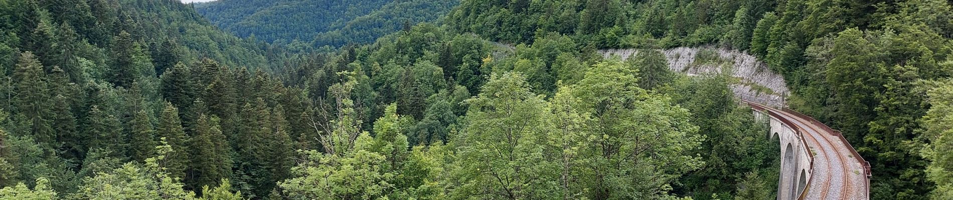
Vous allez decouvrir des ponts de singe, des sentiers escarpés et de jolis paysages de la vallée de la Bienne, sans oublier le trou bleu.
Photos


Positioning
Country:
France
Region :
Bourgogne-Franche-Comté
Department/Province :
Jura
Municipality :
Hauts de Bienne
Location:
Morez
Start:(Dec)
Start:(UTM)
271215 ; 5157372 (32T) N.
Comments